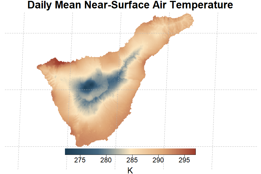
CHELSACanaryClim-climatologies is a very-high resolution climate dataset generated with the CHELSACanaryClim downscaling model. It consists of monthly climatologies of air-temperatures and precipitation.
- Start Time
- 1979-01-01
- End Time
- 2013-12-31
- Status
- finished
- Version
- 1.0
This is the overview rich text!
Key Figures
- License
- Creative Commons Zero - No Rights Reserved (CC0 1.0)
- File Format
- COG
- Publication Date
- 9.2025
- Model Citation
- Patiño, J., Collart, F., Vanderpoorten, A.; Martin-Esquivel, J.L., Naranjo-Cigala, A., Mirolo, S., Karger, D.N. (2023). Spatial resolution impacts projected plant responses to climate change on topographically complex islands. Diversity and Distributions 29(10) 1245-1262.
- Data Citation
- Karger, D. N., Collart, F., Vanderpoorten, A., Martin-Esquivel, J. L., Naranjo-Cigala, A., Mirolo, S., Patiño, J. (2025). CHELSACanaryClim-climatologies. EnviDat. https://www.doi.org/10.16904/envidat.692